Texas is large enough that a drive from its easternmost point to its westernmost point covers roughly the same distance as driving from Chicago to Atlanta. That scale is the reason a single “map of Texas” question actually breaks down into several separate ones: which region, which county, which time zone, and which of the state’s four international and out-of-state borders you’re closest to.
Texas Size and Geography
At 268,596 square miles, Texas is the second-largest US state by area, trailing only Alaska. It’s larger than every country in Western Europe except France, and roughly the size of France and the United Kingdom combined. That footprint spans four distinct physical environments: humid pine forest in the east, coastal plain along the Gulf, semi-arid rangeland across the center and south, and true desert and mountains in the far west near El Paso.
Major Geographic Regions of Texas
Texas is commonly divided into seven traditional regions: the Piney Woods of East Texas (dense pine forest bordering Louisiana), the Gulf Coast (Houston, Corpus Christi and the barrier islands), South Texas Plains (brush country running down to the Rio Grande Valley), the Hill Country (the limestone terrain around Austin and San Antonio known for wineries and rivers), Prairies and Lakes (the Dallas-Fort Worth area and North Texas), the Panhandle Plains (flat, wind-swept high plains around Amarillo and Lubbock), and Big Bend Country in the far west, home to the Chisos Mountains and the Trans-Pecos desert.
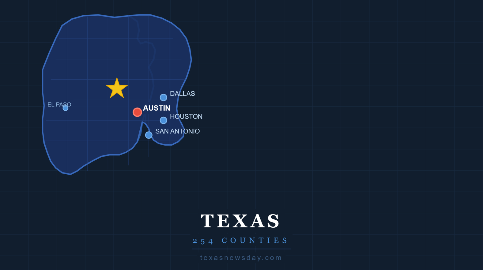
Texas County Map
Texas has 254 counties, more than any other state by a wide margin (Georgia is second with 159). Loving County, in the far west, is the least populous county in the entire United States. Harris County, home to Houston, is the most populous, with more residents than 24 individual US states. That range — from a few dozen residents to millions — is part of why a single statewide policy in Texas can look completely different in practice from one county to the next.
Major Texas Cities on the Map
Houston is the largest city and sits on the Gulf Coast; San Antonio and Austin anchor the Hill Country corridor along I-35; Dallas and Fort Worth form the Metroplex in North Texas; and El Paso sits alone in the far west, closer to Los Angeles than to Houston and separated from the rest of the state by hundreds of miles of desert. Austin, the state capital, is smaller than Houston, San Antonio, Dallas and Fort Worth — a detail that surprises people who assume the capital is automatically the largest city.
Texas Borders and Neighboring States
Texas borders four US states — New Mexico to the west, Oklahoma to the north (with the Red River forming most of that line), Arkansas to the northeast, and Louisiana to the east — plus four Mexican states along the Rio Grande: Chihuahua, Coahuila, Nuevo León and Tamaulipas. That makes Texas the only US state bordering four different Mexican states, which is also why its international border stretches roughly 1,250 miles, longer than the US-Mexico border of any other state.
Texas Time Zones on the Map
Almost all of Texas runs on Central Time. The exception is the far western tip of the state — El Paso, Hudspeth County, and a handful of nearby counties — which runs on Mountain Time, an hour behind the rest of the state. That means it’s possible to be in Texas and have a different local time than someone else in Texas, which regularly trips up scheduling for statewide businesses and government offices.
Best Texas Maps Online
For driving directions, Google Maps and Apple Maps cover Texas roads reliably. For county-level detail, the Texas Department of Transportation (TxDOT) publishes free downloadable county highway maps and a statewide travel map. For real-time road conditions, TxDOT’s DriveTexas.org tool overlays construction and closures on a live map, which is more useful than a static map for anyone planning a long-distance drive across the state.
Frequently Asked Questions
How many counties does Texas have?
254 — more than any other US state. Harris County is the most populous; Loving County is the least populous county in the entire country.
What are the major regions of Texas?
The seven traditional regions are the Piney Woods, the Gulf Coast, South Texas Plains, the Hill Country, Prairies and Lakes, the Panhandle Plains, and Big Bend Country.
How big is Texas compared to other states?
At 268,596 square miles, Texas is the second-largest state after Alaska, and is roughly the combined size of France and the United Kingdom.
What river forms the border between Texas and Mexico?
The Rio Grande forms the entire Texas-Mexico border, running roughly 1,250 miles along the state’s southern edge.
No. Most of the state is on Central Time, but El Paso and a few nearby far-western counties are on Mountain Time, an hour behind the rest of Texas.